(ภาษาไทย) เกาะปันหยี
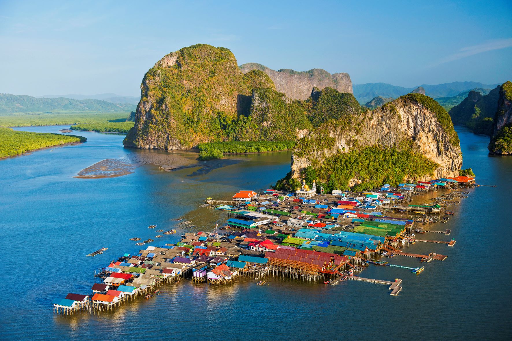
Koh Panyee is a small island with a plain about 1 rai, with 200 houses, most of the people are Muslims. The main occupation is fishing.
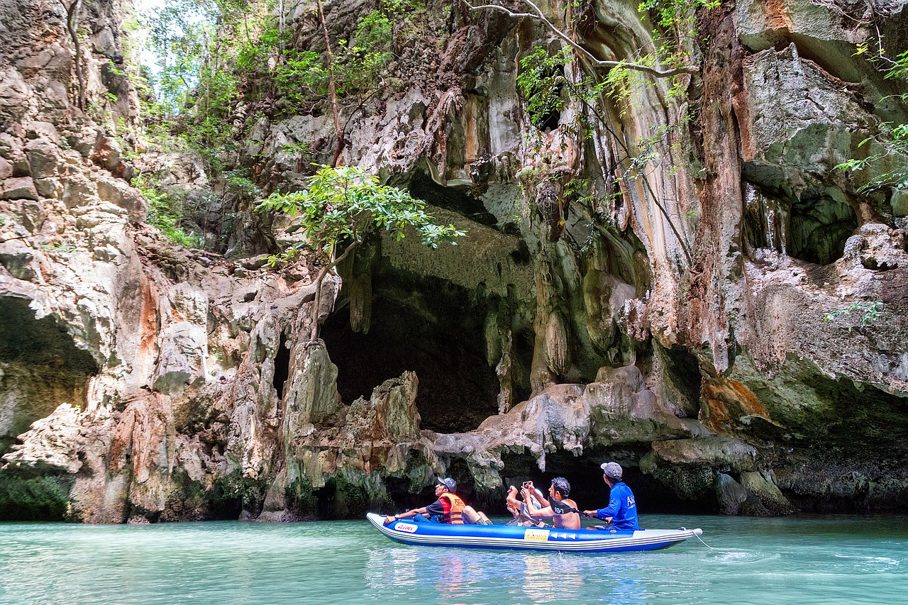
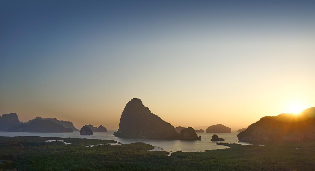
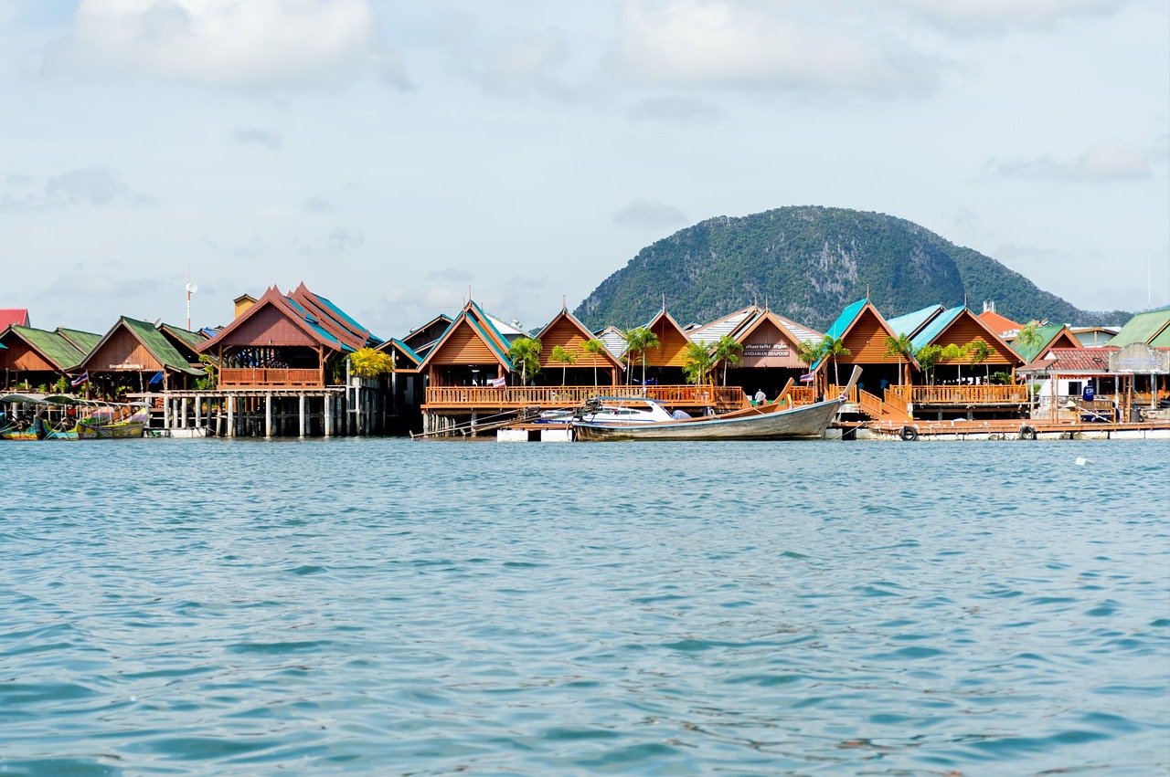 It is a limestone mountain that looks tall and wide. Can block wind waves very well There is a sandy shoal that has accumulated until the ground is flat. It is the location of 4 small villages, creating colors in the midst of nature surrounded by large and small islands in the sea and mangrove forests of Ao Phang Nga National Park. Ancestors of Koh Panyee They are 3 Javanese families who emigrated from Indonesia by 3 sailboats in the late 18th century and agreed that if they found a suitable area to plant a flag as a symbol, the word "Pulau Panji" means "flag" when settling on this island has been living in the context of Islamic culture for more than 300 years It consists of a population of about 1,400 people, most of which are almost 350 houses, one-story houses built on a high platform lined in the sea, Phang Nga Bay, in front of a limestone cliff. The area at the foot of the mountain is about 1 rai. Ko Panyee people use it as the central area of the village. It is the area of the cemetery and the location of the Darussalam Mosque. The construction is a two-storey building. The top of the dome has a distinctive golden color. The interior of the building is decorated with marble. The nature of the sea is conducive to shallow water fishing. Raising cockles raising fish in cages is the main income of the villagers But when more tourists visit causing the villagers to turn to supplementary occupations whole restaurant Hire a boat driver and sell souvenirs. Most of which are dried and processed seafood. and Koh Panyee It is also a very famous source of jewelry made from mother of pearl. Therefore generate income for the community as well during the monsoon-free period Between December and April, nearby is the location of Mount Khao. which has red paintings depicting people and aquatic animals located about 400 meters before reaching Koh Panyee, and Tham Talu which is not far apart It is an island in the middle of the water where there is a hole that can pass through. It is another tourist canoeing point in the park. How to get there: One-day tour packages can be purchased from travel agencies in Phuket. or ports in Phang Nga province such as Tha Dan Pier Mueang Phang Nga District Surakul Pier and Ban Hin Rom Pier Takua Thung District, etc.
ที่มา : https://thai.tourismthailand.org/Attraction/เกาะปันหยี
It is a limestone mountain that looks tall and wide. Can block wind waves very well There is a sandy shoal that has accumulated until the ground is flat. It is the location of 4 small villages, creating colors in the midst of nature surrounded by large and small islands in the sea and mangrove forests of Ao Phang Nga National Park. Ancestors of Koh Panyee They are 3 Javanese families who emigrated from Indonesia by 3 sailboats in the late 18th century and agreed that if they found a suitable area to plant a flag as a symbol, the word "Pulau Panji" means "flag" when settling on this island has been living in the context of Islamic culture for more than 300 years It consists of a population of about 1,400 people, most of which are almost 350 houses, one-story houses built on a high platform lined in the sea, Phang Nga Bay, in front of a limestone cliff. The area at the foot of the mountain is about 1 rai. Ko Panyee people use it as the central area of the village. It is the area of the cemetery and the location of the Darussalam Mosque. The construction is a two-storey building. The top of the dome has a distinctive golden color. The interior of the building is decorated with marble. The nature of the sea is conducive to shallow water fishing. Raising cockles raising fish in cages is the main income of the villagers But when more tourists visit causing the villagers to turn to supplementary occupations whole restaurant Hire a boat driver and sell souvenirs. Most of which are dried and processed seafood. and Koh Panyee It is also a very famous source of jewelry made from mother of pearl. Therefore generate income for the community as well during the monsoon-free period Between December and April, nearby is the location of Mount Khao. which has red paintings depicting people and aquatic animals located about 400 meters before reaching Koh Panyee, and Tham Talu which is not far apart It is an island in the middle of the water where there is a hole that can pass through. It is another tourist canoeing point in the park. How to get there: One-day tour packages can be purchased from travel agencies in Phuket. or ports in Phang Nga province such as Tha Dan Pier Mueang Phang Nga District Surakul Pier and Ban Hin Rom Pier Takua Thung District, etc.
ที่มา : https://thai.tourismthailand.org/Attraction/เกาะปันหยี
Read more
It is a limestone mountain that looks tall and wide. Can block wind waves very well There is a sandy shoal that has accumulated until the ground is flat. It is the location of 4 small villages, creating colors in the midst of nature surrounded by large and small islands in the sea and mangrove forests of Ao Phang Nga National Park. Ancestors of Koh Panyee They are 3 Javanese families who emigrated from Indonesia by 3 sailboats in the late 18th century and agreed that if they found a suitable area to plant a flag as a symbol, the word "Pulau Panji" means "flag" when settling on this island has been living in the context of Islamic culture for more than 300 years It consists of a population of about 1,400 people, most of which are almost 350 houses, one-story houses built on a high platform lined in the sea, Phang Nga Bay, in front of a limestone cliff. The area at the foot of the mountain is about 1 rai. Ko Panyee people use it as the central area of the village. It is the area of the cemetery and the location of the Darussalam Mosque. The construction is a two-storey building. The top of the dome has a distinctive golden color. The interior of the building is decorated with marble. The nature of the sea is conducive to shallow water fishing. Raising cockles raising fish in cages is the main income of the villagers But when more tourists visit causing the villagers to turn to supplementary occupations whole restaurant Hire a boat driver and sell souvenirs. Most of which are dried and processed seafood. and Koh Panyee It is also a very famous source of jewelry made from mother of pearl. Therefore generate income for the community as well during the monsoon-free period Between December and April, nearby is the location of Mount Khao. which has red paintings depicting people and aquatic animals located about 400 meters before reaching Koh Panyee, and Tham Talu which is not far apart It is an island in the middle of the water where there is a hole that can pass through. It is another tourist canoeing point in the park. How to get there: One-day tour packages can be purchased from travel agencies in Phuket. or ports in Phang Nga province such as Tha Dan Pier Mueang Phang Nga District Surakul Pier and Ban Hin Rom Pier Takua Thung District, etc.
ที่มา : https://thai.tourismthailand.org/Attraction/เกาะปันหยี
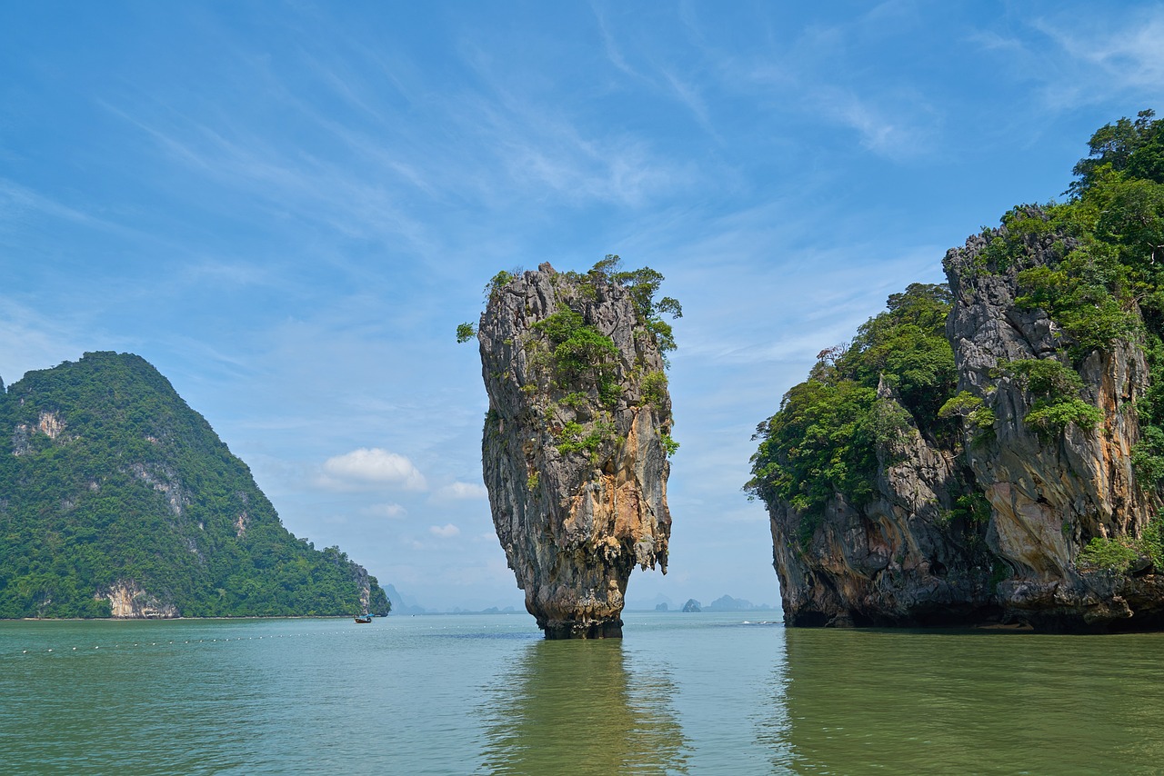
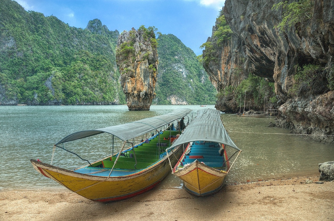 Khao Tapu is a small rock. Located on the northern side in the cove of Koh Khao Phing Kan. in the southwest of Ao Phang Nga National Park in Kalai Sub-district, Takua Thung District, Phang Nga Province, far from the park office along the canal Koh Panyee for a distance of about 15 kilometers. Koh Tapu looks like a single island. The upper part bulges out and narrows at the base like a crab's eye. (This island has a geological term called Koh Hin Doong). To see Koh Tapu, you must see it from a distance from a boat. or from the shoal of Khao Phing Kan Island Unable to go on the island
cr: https://www.phangngapao.go.th/travel/detail/128
Thank you for picture by
Khao Tapu is a small rock. Located on the northern side in the cove of Koh Khao Phing Kan. in the southwest of Ao Phang Nga National Park in Kalai Sub-district, Takua Thung District, Phang Nga Province, far from the park office along the canal Koh Panyee for a distance of about 15 kilometers. Koh Tapu looks like a single island. The upper part bulges out and narrows at the base like a crab's eye. (This island has a geological term called Koh Hin Doong). To see Koh Tapu, you must see it from a distance from a boat. or from the shoal of Khao Phing Kan Island Unable to go on the island
cr: https://www.phangngapao.go.th/travel/detail/128
Thank you for picture by